|
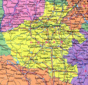
Henan Province Overview
Hebei Province, abbreviated as Yu in Chinese, is located along the middle and lower reaches of Yellow River (Huang He). It covers an area of over 160,000 square kilometers, and has a population of 100.1 million. The capital city of Henan Province is Zhengzhou.
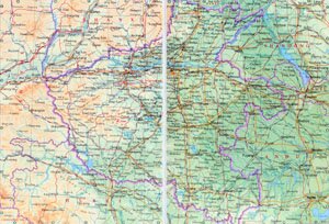
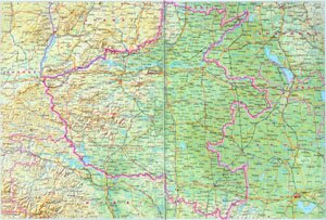
Henan Province Geography: The terrain of Henan Province decends from west to east. Major mountains in Henan are Mount Funiu Shan, Mt. Xiao Shan, Mt. Xiong'er Shan, Mt. Waifang Shan, Mt. Taihang Shan, Mt. Tongbai Shan and Mount Dabie Shan. Major rivers are branches of Yellow River, Huai River, Wei River and Han Shui.
Henan Province Climate: Henan enjoys a humid and semi-humid continental monsoon climate, characterized with distinctive seasonal difference. With an annual rainfall of 700 ~ 1,100mm, the average annual temperature is between 13 ~ 15 ℃, and 0 ~ 2℃ in January and 26 ~ 28℃ in July.
Henan Province Agriculture: Having a long history of agricultural producing, Henan is a major production region of grain, cotton and tobacco in China. Animal husbandry in Henan is mainly of raising pigs and cows.
Henan Province Industry: Henan has rich mineral resources and it is a major production region of coal and oil.
Tourist Resources of Henan Province: Henan has four of the eight most famous ancient capital in China, of which Anyang was the earliest one, Luoyang has been capital for nine dynasities and Kaifeng has been seven. Henan also has rich cultural relics: Longmen Grottoes, Songshan Shaolin Temple etc.
|