|
Xinjiang Province Overview
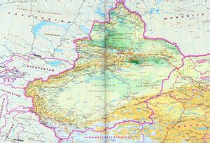
Xinjiang Autonomous Region, abbreviated as Xin in Chinese, is located along the northwest border of China. It covers an area of over 1.6 million square kilometers, and has a population of 19.62 million. The capital city of Xinjiang Province is Urumqi.
Xinjiang Province Geography: Xinjiang's topography characterizes with three broadly parallel mountain ranges with two basins lying between them. The Tianshn Mountains runs in the middle of the province and divides Xinjiang into north and south. North across the Junggar Basin is Mountain Altay and across the Tarim Basin to the south are Kunlun Mountains. China's largest desert, Taklimakan Desert is in the south while the second largest one, Gurbantunggut Desert is in the north. Major rivers are Tarim River, Ili River and Ertix River.
Xinjiang Province Climate: Xinjiang enjoys typical arid continental climate, characterized with strong sunshine, minimum rainfall and a sharp change in deily temperature. With an annual rainfall of 50 ~ 150 mm, the average annual temperature is between 7 ~ 14 ℃ in the south and - 4 ~ 9 ℃ in the north.
Xinjiang Province Agriculture: Xinjiang depends on oasis irrigation argriculture and wheat is its major crop. Animal husbandry is quite well developed in Xinjiang.
Xinjiang Province Industry: Xinjiang's industries mainly consists of coal mining, oil exploitation and refinement, sugar making, textile, and food production.
Tourist Resources of Xinjiang Province: Heavenly Lake (Tianchi), Heavenly Mountains rage (Tianshan), Kanas Lake, Flaming Mountains, Kirzil's Thousand Buddha Cave, the ancient cities in Jiaohe and Gaochang, Loulan Site, and etc.
|