|
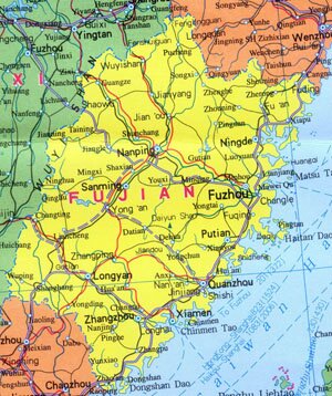
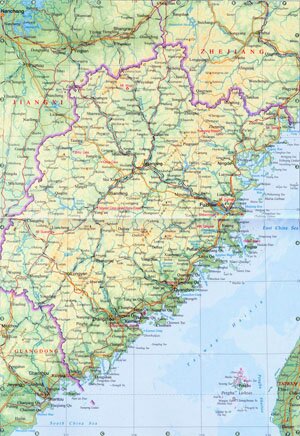
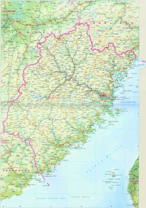
Fujian Province, abbreviated as Min in Chinese, is located on the southeast coast China, facing Taiwan across the Taiwan Strait. It covers an area of over 120,000 square kilometers, and has a population of 33.5 million. The capital city of Fujian Province is Fuzhou.
Fujian Province Geography: Mountains and hills takes up most part of Fujian area. Major mountains in Fujian are Mount Wuyi Shan and Mount Daiyun Shan. The terrain of Fujian gradually slopes from northwest to southeast. Major rivers are Min River, Jin River and Jiulong River. Many favorable seaports along the coast line are Mawei, Xiamen and Dongshan.
Fujian Province Climate: Fujian enjoys a subtropical humid monsoon climate, characterized with seasonal difference and plenty of rains. With an annual rainfall of 1,000 ~ 1,900mm, the average annual temperature is between 17 ~ 22 ℃, and 6 ~ 12 ℃ in January and 28 ~ 29℃ in July.
Fujian Province Agriculture: Major products in Fujian are rice, wheat, sweet potatos, sugar cane, tobaccos and hemps. Prosperous aquaculture is well developed along coastal area, with rich productions of hairtail, yellow-fin tuna, el, shellfish and laver.
Fujian Province Industry: Fujian plays a very importatnt role in light industires and the heavy industires are being developed recently.
Tourist Resources of Fujian Province: Fujian has very beautiful natural scenery which people can see in Mount Wuyi, Gulangyu Island, Mount Wushan, Mount Qingyuan and Mount Taimu. There are many famous temples in Fujian as well, such as Xuefeng Temple, Wanfu Temple, Guanghua Tample and Nanputuo Temple.
|