|
Taiwan Overview
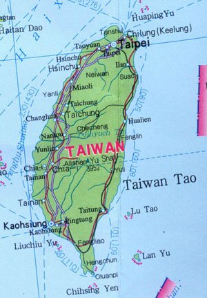
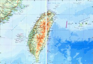
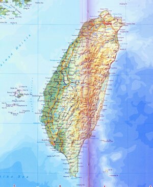
Taiwan Province, abbreviated as Tai in Chinese, is located on the southeast offshore area of China. Covering an area of over 36,000 square kilometers, Taiwan is composed of Taiwan Island, Penghu Archipelago, Lan Yu, Tiaoyu Island and Chihwei Yu. Taiwan has a population of 22.28 million. The capital city of Taiwan is Taipei.
Taiwan Geography: 2/3 of the Taiwan Island is covered with mountains and hills. With mountains like Mt. Hai'an Shan, Mt. Chungyang Shan, Mt. Yu Shan, Mt. Ali Shan and Mt. Hsueh Shan run parallel from northeast to northwest, the terrain of Taiwan Island descends from middle to both sides. There are manu volcanoes on the island. Major rivers are Choshui Hsi, Kaoping Hsi and Tsengwen His.
Taiwan Climate: Taiwan enjoys subtropical humid monsoon climate With an annual rainfall of above 2,000 mm, the average annual temperature is between 20 ~ 25 ℃, and 13 ~ 20 ℃ in January and 24 ~ 29 ℃ in July.
Taiwan Agriculture: Taiwan is a major production area of rice and sugar in China. It is also well known for the tropical fruits it produces.
Taiwan Industry: Light industry has always been well developed in Taiwan, such as textile and food processing. Since 1970s, Taiwan has begin to develop its heaving industries, mainly manufacturing industries.
Tourist Resources of Taiwan: Jihyueh Tan Lake, Ail Mountain, Yangming Mountain, Yushan Mountain, Bugua Mountain, Palace Museum and Mazu Temple.
|